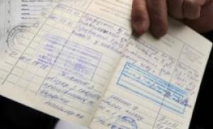
Map of the Belozersk district of the Novgorod province, part 1. Detailed ancient maps of the Novgorod province, land surveying of counties, etc.
Maps of Novgorod province
Maps of Novgorod province
20th century, 19th century, 18th century.
Novgorod province was formed in 1776. 4 provinces were part of it: Novgorod, Tver, Belozersk and Olonets. By the beginning of the twentieth century, the total area of the province was 118,538 km 2, and the population was 1,532,000 people.
In our electronic library Maps of the Novgorod province are available.
If necessary, on commercial terms we are ready to provide them
We are digitizers of ancient maps, survey maps and economic notes - write orders by email!
Available:
Belozersky district
quantity: 39 A3 files, part 2 (eastern).
see sample | prefabricated sheet
The entire province is available in the form of a finished CD. Also in 2011, a reprint was released - an atlas of the Novogorod province of 1863, it contains the previously absent area of Staraya Russa.
Novgorod Governorate borders with: Pskov Governorate, St. Petersburg Governorate, Olonets Governorate, Vologda Governorate, Yaroslavl Governorate, Tver Governorate
Please send applications to
To order PGM - inventory according to RGADA:
General map of the Novgorod governorship m-8th century. Novgorod province 1790
General map of the Novgorod governorship m-21st century. Novgorod province
General district plan m-1 c. Novgorod province Belozersky district 1788
District map m-7 v. Novgorod province Belozersky district
The same - 2nd copy. Novgorod province Belozersky district
Master plan(atlas) of Belozersky district in 13 parts. Part 1 m-2 v. Novgorod province Belozersky district
Part 2 Novgorod province Belozersky district
Part 3 Novgorod province Belozersky district
Part 4 Novgorod province Belozersky district
Part 5 Novgorod province Belozersky district...
Administrative-territorial unit of Russia (from 1727 to 1927) with its center in the city of Novgorod.
The Novgorod province was located in the European part of Russia and bordered in the north with the and provinces, in the east with the and provinces, in the south with the and provinces, and in the west with the and provinces.
History of the formation of the Novgorod province
In 1727, the Novgorod province was separated from the St. Petersburg province and consisted of 5 provinces:
- Belozerskaya (Belozersky, Kargopolsky, Ustyuzhensky and Charondsky districts)
- Velikolutskaya (Velikolutsky, Toropetsk and Kholm districts)
- Novgorodskaya (Novgorod, Novoladozhsky, Olonetsky, Porkhovsky, Staraya Ladoga and Starorussky districts)
- Pskovskaya (Gdovsky, Zavolochsky, Izborsky, Ostrovsky, Pustorzhevsky and Pskov districts)
- Tverskaya (Zubtsovsky, Rzhevsky, Tverskoy, Novotorzhsky and Staritsky districts)
In 1770, Staraya Ladoga and Charonda districts were abolished.
In 1772 (after the first partition of Poland, from the newly annexed lands) the Pskov province was created (the center of the province was the city of Opochka), 2 provinces of the Novgorod province were included in it - Velikolutsk and Pskov (except for the Gdov district, transferred to the Novgorod province).
In 1773, by decree of Catherine II, the Olonets province was created (consisted of two counties and one district). In the same year, Valdai, Borovichi and Tikhvin districts of the Novgorod province and Ostashkovsky district of the Tver province were formed.
In 1775, a separate Tver governorship was created, which included the Tver province and the Vyshnevolotsk district of the Novgorod province. In the same year, the division into provinces was abolished; all districts came directly under provincial subordination.
In 1776, the Pskov province was reformed (from the Pskov and Velikolutsk provinces of the old Pskov province and the Porkhov and Gdov districts of the Novgorod province), the Novgorod governorship was created (from parts of the old Novgorod province, it was divided into 2 regions - Novgorod (Belozersky, Borovichsky, Valdai, Kirillovsky, Krestetsky, Novgorodsky, Novoladozhsky, Starorussky, Tikhvinsky and Ustyuzhensky districts) and Olonetskaya (Vytegorsky, Kargopolsky, Olonetsky, Padansky and Petrozavodsk districts)).
In 1777, a small part of the Novgorod province was allocated to the Yaroslavl governorship. Cherepovets district was formed.
In 1781, the Olonets region and Novoladozhsky district were transferred from the Novgorod governorship to the St. Petersburg province. The division of governorships into regions has been abolished.
By decree of Paul I of December 12, 1796, the Olonets province was abolished, part of its territory was returned to the Novgorod province, in addition, a new division of the Novgorod province into districts was established, and the number of districts was reduced (Belozersky, Borovichsky, Valdai, Vytegorsky, Kargopolsky remained , Olonetsky, Novgorod, Petrozavodsk, Starorussky, Tikhvin and Ustyuzhensky districts), some district towns were transferred to supernumerary ones.
By decree of Alexander I of September 9, 1801, the Olonets province was restored within its old borders (until December 1796). Vytegorsky, Kargopolsky, Olonetsky and Petrozavodsk districts were transferred to it.
In 1802, Kirillovsky, Krestetsky and Cherepovets districts were formed.
In 1824, in connection with the formation of districts of military settlements in the Novgorod province, the Starorussky district was abolished. At the same time, Demyansky district was formed.
In 1859, the Starorussky district was recreated in connection with the liquidation of military settlements.
From 1859 to 1918 included Novgorod province included 11 counties, which included 127 volosts.

| № | County | County town | Area, verst | Population (1897), people |
|---|---|---|---|---|
| 1 | Belozersky | Belozersk (5,015 people) | 13 057,7 | 86 906 |
| 2 | Borovichsky | Borovichi (9,431 people) | 9 045,2 | 146 368 |
| 3 | Valdai | Valdai (2,907 people) | 5 772,7 | 95 251 |
| 4 | Demyansky | Demyansk (1,648 people) | 4 322,9 | 79 791 |
| 5 | Kirillovsky | Kirillov (4,306 people) | 12 171,7 | 120 004 |
| 6 | Krestetsky | Sacrum (2,596 people) | 7 878,2 | 104 389 |
| 7 | Novgorod | Novgorod (25,736 people) | 8 803,4 | 185 757 |
| 8 | Old Russian | Staraya Russa (15,183 people) | 8 379,5 | 191 957 |
| 9 | Tikhvinsky | Tikhvin (6,589 people) | 16 169,3 | 99 367 |
| 10 | Ustyug | Ustyuzhna (5,111 people) | 11 317,1 | 99 737 |
| 11 | Cherepovetsky | Cherepovets (6,948 people) | 7 245,7 | 157 495 |
The Democratic Congress of Soviets (May 10-13, 1918), at the request of the northern districts of the province, positively resolved the issue of separating Tikhvin, Ustyuzhensky, Cherepovets, Kirillovsky and Belozersky districts into the Cherepovets province.
Since April 1918, eight northwestern provinces - Petrograd, Novgorod, Pskov, Olonetsk, Arkhangelsk, Vologda, Cherepovets and Severodvinsk - were united into the Union of Communes of the Northern Region, which ceased to exist in 1919. Belozersky, Kirillovsky, Tikhvinsky, Ustyuzhensky and Cherepovets districts were transferred to the new Cherepovets province.
On June 7, 1918, by resolution of the Novgorod provincial executive committee, Bologovsky district was formed by allocating to it part of the volosts of Valdai district. In the same year, Malovishersky district was created. Already in 1919, the central authorities abolished the Bologovsky district.
In 1921 it became part of the North-Western Region (the region was abolished on January 1, 1927).
In 1922, Krestetsky district was abolished.
In 1924, in accordance with the Regulations of the All-Russian Central Executive Committee on the consolidation of volosts in the Novgorod province, out of 133 volosts, 65 were formed (with 15 thousand people in each).
On August 1, 1927, the Novgorod province was abolished. It became part of the Leningrad region as the Novgorod and Borovichi districts.
Additional materials on the Novgorod province


- Plans for general land surveying of the counties of the Novgorod province
Borovichevsky district 1 mile - Valdai district 1 mile - Kirillovsky district 1 mile -
Maps of Novgorod province
| Name | Example | collection sheet | Download | |||
| PGM Novgorod district | 1c | 1785 | 217.5mb | |||
| PGM Borovichi district | 1c | 1785 | 191.6mb | |||
| PGM Valdai district | 1c | 1785 | 134.1mb | |||
| PGM Starorussky district | 1c | 1785 | 169.3mb | |||
| PGM Kirilovsky district (2 parts) | 1c | 1785 | 301.5mb | |||
| PGM Krestetsky district | 1c | 1785 | 176.1mb | |||
| PGM Tikhvin district | 1c | 1785 | 207.1mb | |||
| PGM Ustyuno-Zheleznodolsk district (2h) | 1c | 1785 | 104.7mb | |||
| PGM Cherepovets district | 1c | 1785 | 241.1mb | |||
| Map of the surroundings of Novgorod | 1c | XIX century | 30.2mb | |||
| EP Kirillovsky district | XVIII century | 115.8mb | ||||
| EP Cherepovets district | XVIII century | 149.1mb | ||||
| Lotsmanskaya river map Volga(from N. Novgorod to the Kama river) | 500m | 1927 | 157.5mb | |||
| Plan of the Sheksna River (from Belozersk to Cherepovets) | 1c | 1890 | 22.4mb | |||
| Plan of the Volkhov River (from Ilmen to Ladoga) | 1c | 1886 | 288.7mb | |||
| Map of Lake Ilmen . (Water route from Novgorod to Staraya Russa.) | 0.5v | 1870 | 54.2mb | |||
|
Topographer. Bezkornilovich map (2,3,4,5,7,8,9,10,11,12,13,14) |
5v | 1847 | 65.7mb | |||
| Schubert map | 3v | 734.5mb | ||||
| I-O37 Red Army(Cherepovets-Borisovo Sudskoe) | 3km | 1949 | 12.9mb | |||
| II-O37Red Army(Kirilov-Vologda) | 3km | 1949 | 13.5mb | |||
| VII-P37Red Army(Belozersk-Vytegra) | 3km | 1949 | 13.4mb | |||
| Lists of populated places | 366.8mb | |||||
| Schubert map | 3v | 1880 |
Maps are available for free download
Maps are not available for free download, to receive maps - write to mail or ICQ
Historical information on the province
Novgorod province - administrative-territorial unit of Russia (from 1727 to 1927) with a center in the city of Novgorod. In terms of area (from 1859 to 1917) - the 11th territorial entity in the European part of Russia .
Story
Territory of the province
Since 862 - Novgorod Land, the first center - Rurik Settlement.
Since 1478 it has been part of Moscow Rus'.
In 1708 it became part of the Ingermanland province (since 1710 St. Petersburg)
In 1727, the Novgorod province was separated from the St. Petersburg province and consisted of 5 provinces (Novgorod, Pskov, Velikolutsk, Tver and Belozersk).
In 1772 (after the first partition of Poland, from the newly annexed lands) the Pskov province was created (the center of the province was the city of Opochka), and 2 provinces of the Novgorod province, Pskov and Velikolutsk, were included in it.
In 1773, by decree of Catherine II, the Olonets province was created (consisted of two counties and one district).
In 1775, the Tver governorship was created, and the Tver province and the Vyshnevolotsk district of the Novgorod province were included there.
In 1776, the Pskov province was reformed (from the Pskov and Velikolutsk provinces of the old Pskov province and the Porkhov and Gdov districts of the Novgorod province), the Novgorod governorship was created (from parts of the old Novgorod province, it was divided into 2 regions - Novgorod and Olonetsk).
In 1777, a small part of the province was allocated to the Yaroslavl governorship.
In 1781, the Olonets region and Novoladozhsky district were transferred from the Novgorod governorship to the St. Petersburg province.
By decree of Paul I of December 12, 1796, the Olonets province was abolished, part of its territory was returned to the Novgorod province, in addition, a new division of the province into counties was established, and the number of counties was reduced, some county towns were transferred to provincial towns.
By decree of Alexander I of September 9, 1801, the Olonets province was restored within its old borders (until December 1796).
In 1865, the province became a “zemstvo” and the institution of local government (zemstvo) was introduced.
IN late XIX century, consisted of 11 counties, which included 127 volosts.
The Democratic Congress of Soviets (May 10-13, 1918), at the request of the northern districts of the province, positively resolved the issue of separating Tikhvin, Ustyuzhensky,Cherepovets, Kirillov and Belozersky districts became part of the Cherepovets province.
Since April 1918, eight northwestern provinces - Petrograd, Novgorod, Pskov province, Olonets province, Arkhangelsk, Vologda, Cherepovets and Severodvinsk - were transformed into the Union of Communes of the Northern Region, which ceased to exist in 1919.On June 7, 1918, by resolution of the Novgorod provincial executive committee, Bologovsky district was formed by allocating to it part of the volosts of Valdai district. But in 1919, the central authorities abolished the district.
In 1921 it became part of the North-Western Region (the region was abolished on January 1, 1927)
Composition of the province:
Belozersky district
Bologovsky district
Borovichi district
Valdai district
Borovenskaya volost
Demyansky district
Kirillovsky district
Krestetsky district
Malovishersky district
Novgorod district
Novoladozhsky district
Starorussky district
Tikhvin district
Ustyuzhensky district
Cherepovets district
* All materials presented for downloading on the site are obtained from the Internet, so the author is not responsible for errors or inaccuracies that may be found in the published materials. If you are the copyright holder of any material presented and do not want a link to it to be in our catalog, please contact us and we will immediately remove it.