Academic detachment (Great Northern Expedition). Presentation on the topic: Expeditions General information about travel


1 of 22
Presentation on the topic: Expeditions
Slide no. 1

Slide description:
Slide no. 2

Slide description:
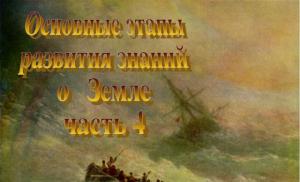
Aivazovsky I.K. “Shipwreck” The period from the mid-15th century to the mid-17th century, marked by the largest geographical discoveries made by European travelers, is commonly called the AGE OF GREAT GEOGRAPHICAL DISCOVERIES. Great geographical discoveries went in 3 directions: along the southern route - around Africa; Western - across the Atlantic Ocean; Northern water - along the northern edges of Eurasia and North America, land - through Northern Asia. In the era of the GREAT GEOGRAPHICAL DISCOVERIES, geography became one of the most important sciences for humanity. She was enriched with extensive information about the structure of the Earth's surface, collected a lot of data about the nature and population of almost the entire land, and received new ideas about the nature of the World Ocean. At that time, GEOGRAPHY performed mainly the function of EARTH DESCRIPTION, answering the questions: WHAT? WHERE? Geographical works, maps and descriptions of that time served mainly as reference books. Age of Discovery
Slide no. 3

Slide description:
Slide no. 4

Slide description:
Aivazovsky I.K. "Sea. Moonlit Night” 1878 In the second half of the 17th and 18th centuries, travelers continued to search for new sea passages around the continents, new lands in the oceans, and explored the interiors of continents unknown to science. During this period, SCIENTIFIC EXPEDITIONS were organized for the first time, the purpose of which, along with discoveries, was to study and explain the causes of geographical phenomena and processes, and the nature of individual territories. Land description tasks were gradually replaced by research tasks. Scientific expeditions
Slide no. 5

Slide description:
The Great Northern Expedition The historical voyage of Fedot Popov and Semyon Dezhnev in 1648 completed the Russian discovery of the coast of the Arctic Ocean from the White Sea to Chukotka. After this expedition, a strait was supposed to appear on the maps, connecting two oceans: the Arctic and the Pacific. However, not everyone believed in its existence, including the top officials of the Russian state. Too many obvious and hidden contradictions were contained in petitions and reports compiled by Russian pioneers of the 16th-17th centuries who were not very literate and not sufficiently experienced in geographical wisdom. Their “tales” were considered fiction, legends. Even Emperor PETER THE GREAT himself did not fully understand the true size and boundaries of his own possessions in the north and east of the giant power. That is why, a few months before his death, he ordered a special expedition to be equipped, which was designed to answer the “eternal” question:
Slide no. 6

Slide description:
Great Northern Expedition Ship of Peter I. The boat of Peter I is the grandfather of the Russian fleet. “WHERE DOES THIS EARTH MEET AMERICA?” And in January 1725, the advance detachment of the expedition, which began to be called the First Kamchatka, set off on a journey that was “the most distant and difficult and had never been done before.” The expedition was led by captain of the first rank of the Russian fleet Vitus Bering (1681 - 1741).
Slide no. 7

Slide description:
Great Northern Expedition The Great Northern Expedition is one of the largest Russian expeditions (1733-1743), the project of which was developed by the Senate together with the Admiralty Board at the St. Petersburg Academy of Sciences, several thousand people took part in it. Essentially, it united several expeditions that carried out a huge range of studies of the northern territory of Siberia - from the mouth of the Pechora and Vaygach Island to Chukotka, the Commander Islands and Kamchatka. For the first time, the shores of the Arctic Ocean from Arkhangelsk to the mouth of the Kolyma, the coast of the island of Honshu, and the Kuril Islands were mapped. This name “Great Northern” accurately characterizes it, because there was no more grandiose geographical enterprise before it. (read the book by B.G. Ostrovsky) St. Petersburg Academy of Sciences.
Slide no. 8

Slide description:
The Great Northern Expedition And it all started with Peter the Great’s decree, which ordered Vitus Bering’s Kamchatka expedition to find out “...whether America and Asia have come together... and put everything on the line.” A map of the western coast of the peninsula and the 16 Kuril Islands was compiled, but there was no answer to the question about the existence of a strait between Asia and America. Then the Senate established a new Kamchatka expedition. “This expedition is the most distant and difficult and has never before been carried out to such unknown places,” said the Decree of the Senate. The goal of the northern detachments of this expedition was to describe the shores of the Arctic Ocean from the mouth of the Northern Dvina to the Chukchi Sea and test the possibility of sailing along the coast of Siberia. The grave of Vitus Bering on the Commander Islands.
Slide no. 9

Slide description:
Great Northern Expedition The most important routes of the Great Northern Expedition of 1734-1742. SWIMMING: S. Muravyov and M. Pavlov 1734 S. Malygin and A. Skuratov 1736-1737 Dmitry Ovtsyn 1734, 1735, 1736-1737 Fyodor Minin 1738, 1739, 1740 Vasily Pronchishchev 1735-1736 Khariton Laptev and Semyon Chelyuskin 1739-1742. P. Lasinius and Dmitry Laptev 1735-1739 LAND ROUTES: Semyon Chelyuskin, Khariton Laptev, Nikifor Chekin 1740-1742. Dmitry Laptev 1741-1742 The voyage of V.I. Bering and A.I. Chirikov led to the discovery of part of the coastal regions of North-West America, the adjacent islands, part of the Aleutian Islands and the Bering Islands. From Kamchatka to the detachment of M. Shpanberg and V. Walton sailed to Japan and mapped the Kuril Islands. The expedition also included an Academic detachment, the purpose of which was to explore the interior regions of Siberia and Kamchatka. The published summary maps of the expedition for the first time provided plausible outlines of Northern Asia, part of the coast of North-West America, the Kuril Islands, parts of the Aleutian and other islands of the Pacific Ocean.
Slide no. 10

Slide description:
Great Northern Expedition Icebreaker Vasily Pronchishchev “Chelyuskin” in the ice. Insert a good clear fragment of the NNE part of Russia The Great Northern Expedition is the largest research expedition in the history of mankind. The sea and land detachments of this expedition explored and mapped the northern and northeastern shores of Eurasia, reached the northwestern shores of North America, and discovered a number of islands off the coast of Alaska. As a result of the activities of Russian sailors and explorers during the Great Northern Expedition, the possessions of the Russian Empire spread to three Parts of the World: Europe, Asia and America.
Slide no. 11

Slide description:
Slide no. 12

Slide description:
Mikhail Vasilyevich Lomonosov Mikhail Vasilyevich Lomonosov (1711 - 1765) shortly before his death, in 1763, uttered prophetic words: “Russian power will grow through Siberia and the Northern Ocean.” The smartest eyes of Russia in the 18th century saw many things in nature that were inaccessible to others. Whatever Lomonosov undertook, he was always ahead of his time. M.V. Lomonosov did not make a single trip to unexplored countries. And yet he is rightfully considered one of the founders of Russian geography. In the 18th century, many truly great geographical discoveries were made in Russia. To map the explored areas, in 1739 the Geographical Department was established at the Academy of Sciences, through whose works the Russian Atlas was published six years later. This became an important event in the history of not only Russian, but also world geography. Having studied and summarized the works of the Great Northern Expedition, the great Russian scientist M.V. Lomonosov in the 60s of the 18th century developed a project for “passing the Siberian Ocean to eastern India.” In one of his odes he wrote: The Russian Columbuses, disdaining gloomy fate, will open a new path to the east between the ice, and our empire will reach America.
Slide no. 13

Slide description:
Mikhail Vasilyevich Lomonosov Mikhail Vasilyevich was one of the first to understand how important it is to find and develop the Northern Sea Route. This would revive the economy of the North and Siberia and turn the country into a great maritime power. Lomonosov's contribution to the future development of the Northern Sea Route is marked on modern maps by the underwater ridge named after him, which rises from the bottom of the Arctic Ocean. Around this place, in the center of the Arctic basin, Lomonosov assumed the existence of a group of islands that change the directions of sea currents. When in April 1760 the Swedish Academy of Sciences elected M.V. Lomonosov as an Honorary Member, he, along with a letter of gratitude, sent the work “Discourse on the Origin of Ice Mountains in the Northern Seas” to Sweden. It was the first to describe and classify polar ice; it is explained that floating “ice mountains” (icebergs) come from glaciers descending into the sea; provides information about tides in the northern seas. The scientist is even trying to estimate the mass of ice in various parts of the then completely unexplored Arctic Ocean.
Slide no. 14

Slide description:
Mikhail Vasilyevich Lomonosov Lomonosov was the first in Russia to study the upper layers of the atmosphere. He foresaw that the time would come when, with the help of various instruments, they would be able to predict the weather: then “there will be no heat or rain dangerous in the field,” and ships will “sail the sea comfortably and calmly.” In his work “On the Layers of the Earth,” Lomonosov was one of the first to express the idea of changing the climate of our planet in the process of its development. He associated climate changes with astronomical reasons - fluctuations in the inclination of the polar axis and the plane of the Earth's orbit. Lomonosov wrote the following words about the role of geographical science in the life of society: “What is safer for those who sail the sea, what is more necessary for those traveling in different countries, such as knowing the position of places, the flow of rivers, the distance of cities, the size, abundance and proximity of different lands, the customs, customs and governments of different peoples? GEOGRAPHY clearly shows this.”
Slide no. 15

Slide description:
“RUSSIAN COLUMBUS” Grigory Ivanovich Shelekhov Grigory Ivanovich Shelekhov (1747 - 1795) was a native of the city of Rylsk, Kursk region. The navigator, the first of the Russian merchants, realized the need to create large, economically strong companies that could open new lands. Under his leadership, an expedition was made to the shores of Alaska, which Shelekhov told about in his “Wanderings from Okhotsk to the American Shores.” Shelekhov Bay
Slide no. 16

Slide description:
James Cook, the famous English navigator (1728 - 1779) The expeditions of the famous English navigator James Cook, whose name is on a par with H. Columbus and F. Magellan, made a great contribution to the development of geography. J. Cook made three voyages to then unknown areas of the Pacific Ocean, discovered the eastern shores of Australia, New Zealand, New Guinea and a number of other islands. He explored both the subpolar and polar regions of the Earth, passed through the Bering Strait into the Arctic Ocean. J. Cook's ships also reached the Antarctic Circle, but ice and fog did not allow the navigator to penetrate further south.
Slide no. 17

Slide description:
XVIII - XIX - early XX centuries. The most important stage in the accumulation of knowledge about the Earth Numerous expeditions of the 18th - 19th and early 20th centuries enriched geography with knowledge about the nature and population of the Earth. During this era, the polar regions of our planet were discovered and explored. Names of travelers of this era: Years of travel: Contribution of scientists and travelers to the development of knowledge about the Earth: Ivan Fedorovich Kruzenshtern and Yuri Fedorovich Lisyansky 1803 -1806. The first Russian round-the-world expedition. The description of the trip was outlined by I.F. Kruzenshtern. In the 3-volume work “Journey around the world in 1803 - 1806.” On the ships “Nadezhda” and “Neva”. The description is accompanied by an atlas of 104 maps and drawings; an atlas of maps of the southern seas was compiled; Various oceanological observations were carried out, data was collected on the atmosphere, tides of the World Ocean.
Slide no. 18

Slide description:
Travelers Names of travelers of this era: Years of travel: Contribution of scientists and travelers to the development of knowledge about the Earth: Vasily Mikhailovich Golovnin 1817 - 1819. He made the 2nd Russian trip around the world, which he described in the book “A Voyage Around the World on the Sloop “Kamchatka””. A bay in the Bering Sea, a strait between islands in the chain of the Kuril Islands, a mountain and a cape on Novaya Zemlya, a volcano on Kunashir Island are named after him. Thaddeus Faddeevich Bellingshausen and Mikhail Petrovich Lazarev 1819 -1821. The first Russian Antarctic expedition. The result of the expedition was that it proved the existence of the Southern continent - Antarctica, described the nature of its shores at a number of points and determined the boundaries. The expedition discovered many islands and corrected Cook's discovery. With her work she laid the foundation for the study of the south polar region. Every day, despite difficult meteorological conditions, scientific observations were carried out. In terms of geographical results, the Russian Antarctic expedition was the greatest in the 19th century.
Slide no. 19

Slide description:
Travelers Names of travelers of this era: Years of travel: Contribution of scientists and travelers to the development of knowledge about the Earth: Alexander Humboldt (German naturalist, theoretical geographer, traveler) XIX century “The Second Columbus” he was nicknamed for his 30-volume work “Travel through the tropical regions of the New Sveta”, in which he outlined the results of his 5-year expedition to America. Mountain ranges in Central Asia and North America, a mountain on the island of New Caledonia, a river, a lake, several settlements in North America, Mount Humboldt near Humboldt Bay, a glacier in Greenland, mountains in Australia, New Guinea and New Zealand are named after him. David Livingston (English traveler) Explorer of Central and Southern Africa David Livingston devoted his entire life to the study of this continent. Neither before nor after him has anyone made so many geographical discoveries on this continent.
Slide no. 20

Slide description:
Travelers Names of travelers of this era: Years of travel: Contribution of scientists and travelers to the development of knowledge about the Earth: Petr Petrovich Semenov-Tyan-Shansky 1856 - 1857. For the first time he visited and mapped this huge, unknown to science, mountain system of Central Asia, which before him remained a “blank spot”. As a result of the research, he refuted the erroneous views of A. Humboldt and proved that the Tien Shan mountains are not of volcanic origin, established their vertical natural belts, determined the height of the snow line, drew up an orographic diagram... For almost half a century, Pyotr Petrovich headed the RUSSIAN GEOGRAPHICAL SOCIETY. On his initiative, with his support, under his leadership, extensive research was carried out and works were created on the geographical description of Russia, the 5-volume “Geographical and Statistical Dictionary of the Russian Empire” was compiled, which contained available information about rivers, lakes, seas, mountain ranges, cities, towns, counties, provinces...
Slide no. 21

Slide description:
Travelers Names of travelers of this era: Years of travel: Contribution of scientists and travelers to the development of knowledge about the Earth: Nikolai Mikhailovich Przhevalsky 1870 - 1873 1876 - 1877 1879 - 1880 1883 - 1885 The first European explorer of the interior regions of Central Asia. He explored inaccessible regions of Mongolia, China and Tibet, walked through the endless Mongolian steppes, crossed the Gobi, Alashan, Taklamakan deserts, the Ordos plateau and the northern outskirts of high-mountain Tibet; explored the upper reaches of the Yellow, Yangtze and Tarim rivers, lakes of Central Asia; discovered hitherto unknown mountain ranges in the Nanshan and Kunlun systems... His travels brought world fame to Russian geographical science. By decision of the Russian Academy of Sciences, a GOLD MEDAL was struck in his honor with the inscription “To the first explorer of Central Asia.” Nikolai Nikolaevich Miklouho-Maclay Residents of New Guinea called him “The Man from the Moon.” Many years of research by this Russian scientist and traveler have enriched science with the most valuable ethnographic information about the indigenous population of the Pacific Islands, where the scientist spent many years. The discovery that immortalized his name was his “discovery” of man “among primitive people.”
Slide no. 22

Slide description:
To be continued….. (see PART 5) The latest discoveries of the 20th century. Numerous expeditions of the 18th - 19th and early 20th centuries enriched geography with knowledge about the nature and population of the Earth. During this era, the polar regions of our planet were discovered and explored. Thus, geography moved from the accumulation of traditional reference material to the creation of complex descriptions of countries and individual territories. The first theories arose about the structure of the atmosphere, the movement of air masses, the doctrine of the origin of land relief and its development under the influence of internal and external forces. Geographers put forward the idea of the unity and integrity of the entire nature of the Earth. Travelers
James Cook's discoveries
James Cook (born October 27 (November 7), 1728 – died February 14, 1779) - English naval sailor, explorer, cartographer and discoverer, member of the Royal Society and captain of the Royal Navy. He led three round-the-world expeditions to explore the World Ocean.
Main events of the biography. Expeditions
1759 - 1760 - Explored and mapped the banks of the Canadian St. Lawrence River.
1763 - 1766 - Mapped the shores of Newfoundland.
1768 - 1771 - First Pacific expedition: explored Tahiti and the Community Islands. Mapped the coasts of New Zealand and eastern Australia.
1772 - 1775 - Second trip around the world: explored Tahiti and New Zealand, visited the Marquesas Islands, New Caledonia, the New Hebrides and other islands of Polynesia and Macranesia. For the first time in history he crossed the Antarctic Circle. Explored South Georgia and South Sandwich.
1776 - 1780 - Third voyage around the world: search for the Northwest Passage from the west coast of the North American continent. Return to New Zealand and Tahiti. Visited the Hawaiian Islands.
Explored the west coast of America from Oregon to Point Barrow, Alaska.
1779 - In 1779 he was killed in a skirmish with the Hawaiians.
Whatever may be the public opinion of my voyage, I must, with a feeling of true satisfaction, asking for no other reward than the acknowledgment that I have done my duty, conclude... the report as follows: The facts confirm that we have proved the possibility of preserving the health of a large crew in long voyages, in different climatic conditions, with tireless work.
James Cook. "Journey to the South Pole and Around the World"
One of the most prominent figures in the history of discovery. A man of the Age of Enlightenment, James Cook was not only a discoverer and conqueror of new lands, gaining fame and fortune or opening new routes to trade. Thanks to his voyages, he became an authority on scientific issues.
Walter Kremer. "300 travelers"
James Cook is one of the most prominent English navigators. He was the leader of three round-the-world expeditions. He discovered many islands in the Pacific Ocean, the Great Barrier Reef and the east coast of Australia, and found out the island location of New Zealand. I made attempts to find the Southern continent - Antarctica. A bay near the Kenai Peninsula in Alaska, a group of islands in Polynesia, a strait between both islands of New Zealand, and others bear his name.
Childhood years
1728, October 27 - the ninth child was born into a poor family of a Yorkshire farmhand in the village of Marton, who later gained fame as a national hero of England and strengthened its influence in the Pacific region.
His life was not easy, full of tireless work and perseverance in achieving his goal. Already at the age of seven, the boy began working on the Airy-Holm farm, owned by the landowner Thomas Scottow. It was he who helped the talented child receive a primary education, sending James to school at his own expense.
A few years later, Cook, in the seaside village of Stay, entered the service of the grocery and haberdashery merchant William Sanders, who later claimed that even in his youth, the future traveler was distinguished by his maturity of judgment and subtle calculation. Perhaps it was here, seeing the sea for the first time, that Cook felt his true calling, since a year and a half later, much before the expiration of the 4-year contract, he signed up as an apprentice on the sailing ship "Free Love", transporting coal. Cook retained his love for “coal miners” until the end of his life. He considered these ships the most suitable for long-term voyages in uncharted waters.
First successes
1752 - the smart and powerful Cook became the assistant captain on the ship "Friendship". It was in this position that he found himself at the beginning of the Seven Years' War, when his ship was in the port of London. After some hesitation, the young man volunteered for the English navy, wanting, as he himself said, “to try his luck along the way.” And it didn’t let him down. Just 3 years later, in 1759, Cook received his first officer rank and sailed to Canada on the ship Mercury, sent to conduct military operations on the river. St. Lawrence. There he was able to distinguish himself by taking measurements in the river fairway at the risk of his life and drawing up an accurate map.
After the war ended, Cook concentrated on improving his education. Persistently, without anyone's help, he mastered geometry and astronomy, so much so that his colleagues who studied in expensive special schools were amazed by the depth of his knowledge. He himself assessed his “learning” more modestly.
James Cook's further career, thanks to his unparalleled hard work, intelligence and insight, continuously went up. 1762, September - while participating in military operations against the French in Newfoundland, he made a detailed inventory of Placentia Bay and a topographical survey of its shores, examined the navigation conditions between the island of Newfoundland and the Labrador Peninsula. The result of his labors were eight accurate maps of these places.
Pacific Expedition

1768 - The British Admiralty organized a Pacific expedition to observe the passage of the planet Venus through the disk of the Sun in Tahiti. In addition to the official one, other goals were pursued: to prevent the seizure of new lands by other powers, to resume the creation of strongholds and bases in the region to establish British control here. Great importance was attached to the discovery of new rich lands and the development of trade in “colonial goods,” including slaves. The most suitable candidate as the head of the expedition turned out to be James Cook, who is not yet widely known, but has proven himself well in professional circles.
The lieutenant personally selected a bark on the Thames (the three-masted ship "Endeavour" - "Attempt"), which on June 30, 1768, left the mouth of the Thames, with a crew of 84 people, and in January 1769, having passed Madeira, the Canary Islands, wa Cape Verde, has already rounded Cape Horn and entered the Pacific Ocean. Thus began the Pacific epic of James Cook, which immortalized his name and turned him into a legend.
On April 13, the expedition reached Tahiti, where on June 3, under excellent weather conditions, astronomical observations of Venus were made. From here Cook turned west and rediscovered the Society Islands, named after the London Scientific Society; then he circled New Zealand, finding out that it was a double island, which refuted the opinion of Tasman, who considered it part of the legendary Southern continent.
The next discoveries were the discovery of the previously unknown eastern coast of Australia, the Great Barrier Reef, and the rediscovery of the Torres Strait. Cook's ships eventually sailed around the Cape of Good Hope and returned to England in 1771, completing a voyage that lasted 2 years and 9.5 months. Accurate maps of all surveyed areas were compiled. Tahiti and the surrounding islands were declared possessions of the English crown.
Second trip around the world
The second trip around the world, which lasted from 1772 to 1775, had an even greater resonance. They began to talk about Cook as the new Columbus, Vasco da Gama, Magellan.
The mission of the expedition was associated with the search for the Southern Continent, which had been unsuccessfully searched for by sailors from different countries for several centuries. The Admiralty, greatly impressed by Cook's success, allocated two ships to solve this difficult task.
For almost three years, Resolution and Adventure, James Cook's new ships, were at sea. Leaving Plymouth on June 13, 1772, he was the first of the circumnavigators to explore the entire previously unknown part of the Pacific Ocean between 60° and 70° south. latitude, while crossing the Antarctic Circle twice and reaching 70°10? Yu. w. After discovering huge icebergs and ice fields, Cook became convinced that "the risk involved in sailing in these unexplored and ice-covered seas is so great that ... no man will ever venture further south than I have done" and that lands that "may be in the South will never be explored."
Cook was mistaken, and his mistake - the captain’s authority was so great - slowed down the search for Antarctica for several decades. On his second voyage, Cook discovered South Georgia Island, the South Sandwich Islands, New Caledonia, the New Hebrides, and Norfolk; he also continued research and measurement work.
Third trip around the world

Reconstruction of the Endeavor
Cook rested for a year, receiving a long leave, and on July 12, 1776, he set off on his third and final journey. On the ships "Resolution" and "Discovery", he, now with the rank of captain, sailed in search of a trade route from the Pacific to the Atlantic Ocean around North America - the long-wanted northwest passage.
In this expedition, the group of Hawaiian Islands, named after the then head of the Admiralty by the Sandwich Islands, was rediscovered, the still completely unknown northwestern coast of America, right up to Alaska, was mapped, and the location of Asia and America relative to each other was clarified. In search of the northwest passage, travelers reached 70°41? With. w. near Cape Ledyany, where the ships' path was blocked by pack ice. The expedition turned south, and in November 1778 the crew landed again in the Hawaiian Islands.
Death of James Cook
There a tragedy known to the whole world took place. The Hawaiians had an ancient legend about the god O-Rono, who was supposed to return to Hawaii on a floating island. The priest O-Rono declared Cook a god. The honors given by the islanders were unpleasant to the navigator. However, believing that this would make the team’s stay in Hawaii safer, he did not dissuade the natives.
And among them, a complex struggle between the interests of priests and warriors began. The captain's divine origin was questioned. There was a desire to check it out. Theft at the expedition's camp led to clashes with the natives. The situation became tense, and in one of the clashes, on February 14, 1779, James Cook was killed with a spear to the back of the head. The Hawaiians took the corpse with them, and the next day the priests - friends of the captain - wept and brought back the pieces of the body that they had received during the division. Yielding to the demands of the sailors, Captain Clerk, who replaced Cook, allowed the Hawaiians to be dealt with. The sailors mercilessly killed everyone they came across on their way and burned villages. The natives sued for peace and returned the body parts, which the crew delivered to the sea with great honor.
Contributions made to the history of geographical discoveries
Cook's activities were assessed ambiguously by contemporaries and later researchers. Like any talented and bright personality, he had his fans and enemies. Father and son, Johann and Georg Forster, took part in the second voyage as natural scientists. The elder's beliefs, strongly influenced by Rousseau's ideas about "natural" man, made him a serious opponent of Cook's assessment of many travel situations, especially those related to the relationship between Europeans and natives. Forster was mercilessly critical of Cook's actions and often idealized the islanders.
Serious disagreements arose between the scientist and the captain immediately upon returning from the voyage. Both Forsters categorically refused to adhere to the official plan of travel notes outlined by the Admiralty. Finally, Johann had to give an undertaking not to publish his own account of the trip. But he handed over his notes to Georg, who processed them and still published them three months before the publication of Cook’s notes. And in 1778, Forster Sr. published his “Observations Made During a Voyage Around the World.”
Both books by the Forsters became an interesting commentary on the notes of their former boss and forced their contemporaries to look somewhat differently at the “valiant” and “merciful” behavior of the British during the expedition. At the same time, painting idyllic pictures of heavenly prosperity on the islands of the southern seas, both naturalists sinned against the truth. Therefore, in everything related to the life, religion and culture of the natives, the notes of Cook, a man of a clear and cold mind, are more accurate, although the works of the Forsters for a long time served as a kind of encyclopedia of the countries of the South Seas and were extremely popular.
The dispute between the captain and the scientists has not been resolved to this day. And now not a single serious publication about James Cook can do without quotes or references to the Forsters. Nevertheless, Cook was and remains the brightest star in the constellation of Earth discoverers; he provided his contemporaries with many accurate, objective observations of the nature, customs and morals of the inhabitants of the territories he visited.
It is not difficult to verify this: all three books by J. Cook were published in Russian: “The First Voyage of Captain James Cook. Sailing on the Endeavor in 1768–1771." (M., 1960), “James Cook’s second circumnavigation of the world. Voyage to the South Pole and around the world in 1772–1775,” (M., 1964), “The third voyage of Captain James Cook. Sailing in the Pacific Ocean in 1776–1780." (M., 1971). Despite the distance of what is written from our time, the books are read with keen interest and carry a lot of information, including about the personalities of the captain himself and the people who surrounded him.
Our Pechora-Yugora journey began with the fact that we flew by plane to Naryan-Mar - the only city of the Nenets Autonomous Okrug, and then by taxi we got to the Pechora River, where we collected our kayak on the beach of the village of Iskateley.
Pechora River
We started on the evening of June 28th. The weather did not spoil us from the very beginning - a headwind from the North-West was blowing, it was quite cold - only about 10 degrees. As a result, we walked along Pechora for almost eight days, instead of the planned three or four, because in addition to the resistance of the wind, which invariably blew in our faces, we also had to overcome a very steep and short oncoming wave.
The Pechora is a full-flowing river, so with such winds blowing against its powerful current, it becomes very difficult to pass. In some places we had to stand for a couple of days, waiting out bad weather. There was very high water on the river at that time, and its low banks were often completely flooded with water, above which only impassable thickets of willows protruded, so parking was very difficult.
Five days later the weather improved; one day a southwest wind blew, which was sideways for us and very convenient for sailing. Under sail we quickly moved even closer to the mouth, and two days later we successfully entered the Barents Sea. Now we had to overcome Bolvanskaya Bay - the first obstacle on our way. But the weather turned bad again. We did not dare to cross the bay directly and went around its perimeter under sail.
I must say that our sailing equipment this time was very good and allowed us to sail courses up to 45 degrees to the wind. We invented the spar, and ordered the sails themselves from the St. Petersburg master Sergei Novitsky, all the time I mentally thanked him.
The passage of the small Bolvanskaya Bay took several days. We could only sail for a short time, and most of the time we had to crawl slowly on the oars against the wind. The matter was further complicated by the extremely inconvenient bottom in the lip: it was extremely shallow here, and at low tide the lip dried out many hundreds of meters from the shore, and then the depth for several kilometers reached, God forbid, 15-20 centimeters. With such depth, of course, it is very difficult to walk, scratching your belly.
By the way, here we managed to lose our only compass. What a shame - now you will have to navigate only by the sun, watches and maps.
At sea
But everything comes to an end, and on July 11 we left Bolvanskaya Bay behind, went to the village of Fariha, where we drank tea with a local fisherman and asked him about the local weather and sailing conditions. After that, we moved further to the northeast, passed the no longer working oil terminal in the village of Dresvyanka, and three days later we reached a weather station located ten kilometers west of Cape Konstantinovsky, where we again met fishermen, after talking with them, we went further. Having walked quite a bit from the weather station, we stood on a rather uncomfortable, low and swampy place.
The next day the weather began to deteriorate, a westerly wind rose, favorable to us, but too strong to go further. A day later, a real storm began, which drove a huge amount of water from the ocean onto the shore, because of which its level increased, and our camp was literally almost washed away. We managed to evacuate to a higher place about half an hour before the sea flooded the tundra several kilometers away from the usual coastline.
On July 17, the storm ended and a calm easterly breeze blew again. We rowed further, reaching Cape Gorelka. During the day the weather deteriorated, it began to rain, and the next morning the wind again set to the west and intensified. Having left, we raised the sail, but the transition was limited to fifteen minutes: the wind suddenly increased, it became stormy, and we hastily jumped ashore. Yes, the weather here is very capricious, we had to spend two more days in this place, waiting for the wind to weaken.
The next transition was more successful. Having sailed around the huge shallows, we passed Cape Chernaya Lopatka and stopped at Pakhancheskaya Bay. The place here again turned out to be terribly inconvenient, low. Now we knew for sure that it was the same here, during western storms the tundra would be flooded with sea for several kilometers. All the lakes and streams here turned out to be completely salty, and in search of fresh water we had to go quite far to find at least some fresh puddle.
In the evening of the next day we set off further; we really wanted to quickly reach Varandey, a settlement located exactly in the middle of our route. We decided to cross Pakhancheskaya Bay directly. A light breeze blew from the south, we slowly moved forward, but soon the rain caught up with us. The wind intensified, from the clear south it began to set to the southeast. Both the shores and the low night sun disappeared from view behind the rain - we immediately lost our orientation in space. In order not to accidentally jump out of the bay into the open ocean, we headed east, and a few hours later we found ourselves on the shore, twenty-five kilometers south of the Pesyakov Shar channel. Here we were again beset by problems with water, but we stayed in this place for another day, after which, again under sail, in three passages, we reached Varandey by July 25th.
The sea near Varandey greeted us with high, steep waves and a headwind from the east. We felt mortally tired and, having entered the border post in Novy Varandey, retreated ten kilometers to the west, to Pesyakov Island, where we hoped to wait for more suitable weather. Our fatigue, as it turned out, had a very specific nature: the oxygen content in the air at high latitudes is significantly lower than in the middle zone. The body's need for food and rest increases, and strength becomes much less. Everything was complicated by the fact that we were running out of food, and there was no store in Varandey. Fortunately, the local land is very rich in game, and therefore we were not threatened with hunger. We spent three more days at Pesyakovo, after which we moved on.
The wind was still blowing in our faces, and we moved forward very slowly, making small transitions. So, on August 1, we reached Cape Polyarny, where the semi-abandoned Medynka base was located, guarded by two guards. Here we stayed for two days, ate our food, and then purchased a month’s supply of cereals at a nearby drilling site. Now we could safely move on and, having rounded Cape Medynsky, crossing the Perevozny Bay with a fair wind, we stood twenty kilometers north of Cape Perevozny Nos.
Next, we had to cross the Khaypudyr Bay in a narrow place - the last serious obstacle on the way to Vaygach. On August 7, under sail, we reached the cape, turning near which, we moved through the sixteen-kilometer mouth of the lip to reach its eastern shore. When we left the Perevoznoy nose it was already getting dark, but there was still enough light to see the opposite high shore. The wind died down, we lowered the sails and moved forward with the oars. However, not even an hour had passed before a fresh wind blew from the west at our backs. The wind kept getting fresher, the sky was overcast with clouds, it was getting dark all around and, finally, we began to lose sight of the shore to which we were heading.
Fortunately, the dawn was still visible in the north, and we could confidently steer in the right direction. The waves gradually became steeper and angrier, soon they rolled chaotically from different directions and we finally realized that we had probably been too hasty, having set off across the lip not only at night, but also at low tide. It became clear that now we would end up in a real slog: at low tide, a huge mass of water rushes from the Khaypudyr Bay into the ocean and, colliding with the ocean current, forms very high chaotic waves that rage for several kilometers.
We were mortally afraid of this, but there was no way to go back due to the strong westerly wind. Resigned to the inevitable, we rushed headlong into this mountainous area, and during the rest of the journey we suffered such fear that we almost turned gray.
To understand what sea suloy is, imagine a powerful threshold ten kilometers long, in which there are no stones, but waves of at least two meters in height are constantly raging. However, after a couple of hours we nevertheless overcame the Khaypudyr Bay and in the morning landed six kilometers from Cape Sinkin Nos. The weather deteriorated hopelessly and a storm raged. Here we had to spend another four days waiting out the bad weather. We walked on foot to the uninhabited village of Sinkin, where we met a lone hunter living there, and from whom we learned many interesting local tales.
When the weather improved, we moved on, and in two trips we reached Cape Black Nose near the mouth of the Korotaikha River. Forty kilometers from the mouth is the village of Karatayka, the largest settlement in these places, but it did not interest us then, and on the next crossing we reached the Bolshaya Talata River in Belkovskaya Bay. Here we rested for the day, and on August 16 we headed north along the coast of the Yugra Peninsula.
A fresh south wind was blowing, which, as it turned out later, reached a speed of 21 m/s. In just two days we reached the Yugorsky Shar Strait, where we spent the night at the Bely Nos polar station. Now we only had to cross the strait to achieve our cherished goal. This did not cause any difficulties, and on August 19 we already landed on the white rocky shores of Vaigach Island, near Cape Kanin Nos. Here we finally got the opportunity to rinse our boots in the cold waters of the Kara Sea, the western border of which here runs exactly along the line White Nose - Cape Greben.
From here we decided to return to Karatayka, although there were only 40 kilometers left to Amderma, due to the fact that it was almost impossible to get out of Amderma “to the ground” for real money. Now we were separated from the desired finish by about 200 kilometers, but the wind was persistently blowing from the southwest and we could hardly count on quickly returning back to the mouth of Korotaikha. And so it happened: we crawled 70 kilometers to the hut on the Sedayakha River in six days. We stayed on Sedayakha for several days, waiting out another storm.
In the surrounding area, we were lucky enough to meet reindeer herders and a passing all-terrain vehicle, on which on August 30 we successfully reached Karatayka, from where, also on an all-terrain vehicle, we reached Vorkuta by September 3.
In general, on this journey, out of seventy days in total, there were no more than forty days of travel. And on average, if we divide the total mileage by the total amount of time spent on the expedition, our speed was just over ten kilometers per day. This is very little compared even to the White Sea, where our average daily mileage was almost fifteen kilometers. In addition, as we understood, it was necessary to leave not at the end, but at the beginning of June, as soon as the sea begins to become free of ice. In this case, the duration of the season will not be two months (as in our case), but almost three. After all, at the end of August it is almost impossible to go kayaking here - the wind blows much stronger, it is stormy almost every day, and frosts begin at night.
However, the Barents Sea cannot be called more severe and complex than, for example, the White Sea. Storms happen here and there, and in any sea they are dangerous. If we compare the White and Barents Seas, we can say that in the Barents Sea it is much easier to land on the shore in a kayak - there are no such huge littoral areas covered with viscous silt that prevent you from approaching land.
In the Barents Sea, the bottom is sandy or rocky - wandering along it is a pleasure. At the beginning of summer there are not many storms here and there are quite a few days when the sea is absolutely calm and the water is smooth as glass. Therefore, it cannot be said that the Barents Sea is extremely dangerous and impassable for a kayak. You just have to take into account that storms happen here more often and the strength goes away much faster.
Our difficulties arose not at sea, but on land - due to strong winds, lack of oxygen and cold weather. It took us three times more food than usual, and we ran out of energy twice as fast. For example, in thirty-five days we walked only four hundred kilometers to the Medynsky Gate, and by this time we had almost run out of food stored for two months.
However, despite all the difficulties and surprises, the trip turned out to be simply unforgettable, and we will continue it next year. I think it should be no less interesting and exciting than this.
Well, now, it’s time to move on to reading stories about the Pechora-Yugora journey.
- Forward
Financial authority- Public Sports Foundation “Alp-Sport”
GOLDEN PEAK or SPANTIK is a famous peak in Pakistan, 7028 meters high, famous for its stunningly beautiful marble edge, the so-called “golden buttress”.
Despite the fact that all mountaineering expeditions heading to the Karakoram pass by this peak, its steep edge still remains unclimbed, because The steepness and technical complexity of the route forced the strongest teams in the world to abandon it. To date, only one team from Great Britain, in 1987, has been able to complete the route along the right, flatter part of the wall. The drop of the wall is about 2000 meters, and the most difficult and steep, sometimes overhanging sections are located at a high altitude, above 6500 meters above sea level.
Uniqueness of the expedition “Golden Peak-2000” also lies in the fact that for the first time in history it is planned to climb such a technically difficult route by an international team consisting of the strongest climbers from five European countries: Russia, France, Italy, Hungary and Slovenia. In the current difficult geopolitical situation, when some forces are trying to push Russia away from the European community, when our tourists often only have access to a list of tours to Hungary all year round, this expedition also has invaluable humanitarian significance, demonstrating the priority of the principles of cooperation over the principles of rivalry and confrontation.
From the Russian side, the project involves famous Ekaterinburg climbers, leaders of the Russian technical mountaineering team, multiple champions and prize-winners of Russia and the USSR, international masters of sports Alexander Klenov and Mikhail Davy .
In May 1999, Klenov and Davy, together with Alexey Bolotov and Mikhail Pershin, laid out a new route of the highest category of difficulty to the peak Talai Sagar in the Indian Himalayas. The expedition received a great response, almost all the largest mountaineering magazines in the world published an article about this ascent. The climb was nominated among six nominees for the “Golden Ice Axe,” probably the most prestigious international award in the field of mountaineering.
The film about this expedition took first place at the international film festival in Calcutta in the category “best ascent of the year”; at the Moscow international mountain film festival, the first prize was awarded to the work of cameramen in extreme conditions. The film was shown in full and in part on several regional television companies, on the Rossiya and TVC channels, as well as on Slovenian television. Contacts between the Ekaterinburg duo and the rest of the members of the future team began in 1999 and continued in February 2000 during the international mountaineering assembly organized by the French Federation of Mountaineering and Climbing under the leadership of the president of the federation Jean-Claude Marmier.
In February 2000, during the Assembly, Klenov and Davy climbed a new route of the highest category of difficulty to the legendary Alpine peak Petit Dru , known to Russian television viewers from the classic French film “Death of a Conductor.” The final composition of the expedition was determined to be 7 people: two Russians, two French: Manu Guy and Manu Pellissier and also Italian Erik Svab , Slovenian Marco Prezelj and Hungarian Attila Ozsvath .Information support: The preparation and conduct of the expedition will be covered in detail in a series of publications on the pages of the weekly magazine “New Chronicle”(subscription circulation 22,000 copies), in TV channel news 9?, 4 channel, ATN, on the waves of the radio station “Open Radio - “Romance” ( 90.8 FM), in broadcast cycles NTT(inset on TV channel) Culture"), on Channel 47(understudy of RTR), Information messages are guaranteed on the pages of newspapers “Ural worker”, “Details”, on the city radio network in programs “Studio City” and in other media. At the end of the expedition it will be mounted and shown regionally. Channel 10 full-length documentary film TAU special projects, and also a shorter version was mounted and rented at 2 regional channel and in the program “Sannikov Land”, Stories are shown on all-Russian channels "Russia" And TVC.
Articles will be published in illustrated magazines “Vertical World”, “Ascension”(Russia), "Montagnes", "Vertical"(France), "High"(United Kingdom), "Desnivel" ( Spain) “Su Alto”(Italy), “American Alpine Journal"(USA). Films are planned to participate in international film festivals in Moscow, Italy and France, presentation and screening of the film during the annual mountaineering assembly. The expedition will be covered in detail on several popular Internet sites INTERNET. Expedition dates: The expedition will be carried out with May 16 to June 30, 2000 . Information messages from now to July 2000, film releases in August-September 2000.
Financial support:
Estimated cost of the expedition - US$25,500. Payment for the permit (papers for the right to climb in Pakistan), the liaison officer and the delivery of all cargo to Pakistan was undertaken by the French Federation of Mountaineering and Climbing.
Equipment and supplies for expedition participants are provided by the largest European companies SIMOND, MILLET, BEAL, KONG, GRIVEL
as well as Ekaterinburg companies MANARAGA and URAL ALP – ALVOTITANIUM
. General Sponsor Russian connection is defined - they become known company "VITAPOLYAROS"
The first Russian circumnavigation 1803-1806 Ivan Krusenstern and Yuri Lisyansky
Purpose of the expedition
Make the first circumnavigation in the history of the Russian fleet. Deliver and pick up goods from Russian America. Establish diplomatic contacts with Japan. Show the profitability of direct trade in furs from Russian America to China. Prove the benefits of the sea route from Russian America to St. Petersburg in comparison with the land route. Conduct various geographical observations and scientific research along the expedition route.
Expedition composition
Ships:
Three-masted sloop "Nadezhda", with a displacement of 450 tons, a length of 35 meters. Purchased in England specifically for the expedition. The ship was not new, but it endured all the difficulties of sailing around the world.
Three-masted sloop "Neva", displacement 370 tons. Purchased there specifically for the expedition. He endured all the difficulties of circumnavigating the world, after which he was the first Russian ship to visit Australia in 1807.
Emperor Alexander I personally inspected both sloops and allowed the military flags of the Russian Empire to be raised on them. The emperor accepted the maintenance of one of the ships at his own expense, and the costs of operating the other were covered by the Russian-American Company and one of the main inspirers of the expedition, Count N.P. Rumyantsev. Which ship was taken by whom is not specified.
Personnel
 Head of the expedition Kruzenshtern Ivan Fedorovich.
Age at start – 32 years.
He is also the captain of the expedition's flagship, the sloop Nadezhda.
On board the Nadezhda were:
midshipmen Thaddeus Bellingshausen and Otto Kotzebue, who later glorified the Russian fleet with their expeditions
Ambassador Rezanov Nikolai Petrovich (to establish diplomatic relations with Japan) and his retinue
scientists Horner, Tilesius and Langsdorf, artist Kurlyantsev
mysteriously, the famous brawler and duelist Count Fyodor Tolstoy, who went down in history as Tolstoy the American, also ended up on the expedition.
Every single one of the sailors were Russian - this was Krusenstern’s condition.
The total number of the team is 65 people.

Sloop "Neva":
Commander - Lisyansky Yuri Fedorovich.
Age at start – 30 years.
The total number of the ship's crew is 54 people.
In the holds of both ships there were iron products, alcohol, weapons, gunpowder, and many other things for delivery to Russian America and Kamchatka.
Start of the first Russian round-the-world expedition
The expedition left Kronstadt on July 26 (August 7), 1803. On the way we stopped at Copenhagen, then to the small English port of Falmouth, where the ships were caulked again.
Canary Islands
The expedition approached the archipelago on October 19, 1803. They stayed in the harbor of Santa Cruz for a week and on October 26 headed south.
Equator
On November 26, 1803, ships flying the Russian flag “Nadezhda” and “Neva” crossed the equator for the first time and entered the Southern Hemisphere. According to maritime tradition, a celebration of Neptune was organized.
South America
The shores of Brazil appeared on December 18, 1803. We stopped at the harbor of the city of Destero, where we stayed for a month and a half to repair the mainmast of the Neva. Only on February 4, 1804, both ships moved further south along the South American coast.
Cape Horn
Before rounding Cape Horn, Kruzenshtern and Lisyansky agreed on a meeting place, since both understood that in this place the ships would be easily scattered by bad weather. The first option for the meeting was Easter Island, the alternate was Nukagiwa Island. "Nadezhda" safely rounded Cape Horn and on March 3, 1804 entered the Pacific Ocean.
Nukagiwa
They missed Easter Island in strong winds, so Kruzenshtern went straight to the alternate meeting place on Nukagiwa Island, where he arrived on May 7, 1804. Along the way, the islands of Fetuga and Uaguga from the Marquesas group were mapped. On May 10, the Neva also approached Nukagiwa. A week later, both ships set sail towards the Hawaiian Islands.
Equator
Hawaiian Islands
The ships approached them on June 7, 1804. Here they had to part. "Neva" with a cargo of goods for the Russian-American company went towards Alaska, to Kodiak Island. "Nadezhda" headed for Kamchatka, from where it was necessary to go with the embassy to Japan and explore the island of Sakhalin. The meeting of both ships was now expected only in Macau in September 1805, where the Nadezhda would approach upon completion of the diplomatic mission, and the Neva with a cargo of furs from Russian America.

Journey of Hope
Kamchatka
The Nadezhda entered Avacha Bay on July 14, 1804. The population of Petropavlovsk at that time was about 200 people. Governor General Koshelev arrived here from Nizhnekamchatsk (then the capital of the peninsula), who in every possible way contributed to the repair of the ship and preparations for the visit to Japan. The doctor and the artist left the expedition, and the brawler Tolstoy was forcibly “written ashore.” On August 30, 1804, Nadezhda set course for Japan.
Japan
It is known from the history of Japan that any foreign ships were prohibited from entering Japanese ports. And residents of the Islands of the Rising Sun were strictly prohibited from contacting foreigners. Such forced self-isolation saved Japan from possible colonization and trade expansion by Europeans, and also contributed to the preservation of its identity. Only merchants of the Dutch East India Company were allowed to trade in the port of Nagasaki, the southernmost point of the country. The Dutch had a monopoly on trade with Japan and did not allow competitors into their possessions, hid sea maps with coordinates, etc. Therefore, Krusenstern had to guide the Nadezhda to Nagasaki almost at random, simultaneously surveying the Japanese coast.

To Nagasaki
Krusenstern's ship with Ambassador Rezanov entered Nagasaki harbor on October 8, 1804. On board the Russians were several Japanese, who had once fallen to the Russians as a result of the crash, and whom the expedition carried with them as translators.
A Japanese representative came onto the ship and asked hoo-is-hoo, they say where and why they arrived. Then the Japanese pilot helped the Nadezhda enter the harbor, where they dropped anchor. There were only Japanese, Chinese and Dutch ships in the harbor.
Negotiations with the Japanese
This topic deserves a separate story and a separate article. Let’s just say that the Japanese “blinded” the Russian “diplomatic mission” in the port of Nagasaki until April 18, 1805 - five and a half months! And Kruzenshtern and Rezanov had to go home without a sip.

The Japanese emperor “paused for a long time”, then replied through his officials that there would be no agreements with the Russians, and he could not accept the gifts of the Russian emperor - several huge mirrors in expensive frames. They say that Japan is not able to adequately thank the Russian emperor due to its poverty. Laughter, and that's all! Either the Dutch did a good job here, or the Japanese themselves did not want any contacts with Russia.
True, the Japanese administration supplied the ship with food all the time the ship was in port. And she loaded the road with food, water and plenty of salt completely free of charge. At the same time, Krusenstern was categorically forbidden to return along the western coast of Japan.
Return of "Nadezhda" to Kamchatka
Coming out of Japanese “captivity”, Kruzenshtern decided not to give a damn about the Japanese ban and went along the western coast, putting it on the map. At sea he was his own master and was not afraid of anyone - his past combat experience gave him every reason to do so. He landed on the shore several times and got to know this mysterious country as closely as he could. It was possible to establish contacts with the Ainu - residents of the northern Japanese island of Hokkaido.
Sakhalin
The Nadezhda entered Anivu Bay in the south of Sakhalin on May 14, 1805. The Ainu also lived here and the Japanese administration commanded. Kruzenshtern was determined to explore Sakhalin in more detail, but Rezanov insisted on returning to Kamchatka as soon as possible to report to St. Petersburg on the results of his “embassy”.
Kamchatka
On June 5, “Nadezhda” returned to Petropavlovsk-Kamchatsky. Rezanov went ashore, sent a report to the capital, and he himself departed for Russian America to Alaska on a merchant ship. On July 5, 1805, Nadezhda again went to sea and headed for Sakhalin. But Krusenstern was unable to go around Sakhalin and determine whether it was an island or a peninsula. On August 30, the Nadezhda team entered Avachinskaya Bay of Petropavlovsk for the third time. Kruzenshtern began to prepare for a trip to Macau.
Macau
This is the name of a Portuguese colony-fortress-port on the Chinese coast. Leaving Petropavlovsk on October 9, 1805, “Nadezhda” was in Macau on November 20. The Neva was nowhere to be seen.
Travels of the Neva
Russian America
The sloop "Neva", under the leadership of Lieutenant-Commander Lisyansky, approached Kodiak Island on the southern coast of Alaska on July 10, 1804. The island was one of the first places of capital for the Russians to settle in America. Lisyansky brought the ship into the harbor of St. Paul - a kind of administrative center of this Russian province. Here he learned that an armed attack by the local Indians had been carried out on the second Russian center - the Arkhangelsk Fortress in Sitka Bay, significantly south and east of Kodiak. The fortress was burned and the inhabitants were killed. The conflict broke out not without the help and instigation of the Americans, by which time they began to actively penetrate these places.

Alexander Andreevich Baranov, the legendary ruler of Russian America, went “to war” to recapture the Arkhangelsk fortress with the help of Indians and Aleuts friendly to the Russians. Baranov left Lisyansky a message in which he asked him to urgently come to Sitka to provide armed assistance. However, it took the Neva crew almost a month to unload the ship’s holds and repair the equipment. On August 15, the Neva headed towards Sitka.
Novoarkhangelsk – Sitka
On August 20, Lisyansky was already in Sitka Bay. Here he met Alexander Baranov, who made a strong impression on him. Together they developed a plan for a military operation. The guns and sailors of the Neva played a decisive role in restoring the “status quo” in relations with the Tinklit Indians. Not far from the burned old fortress, a new settlement, Novoarkhangelsk, was founded. On November 10, the Neva left Sitka and headed for Kodiak.

Back in Kodiak
“Neva” arrived within five days. Since winter was approaching, it was decided to spend the winter here, make repairs, rest and fill the holds with precious junk - the furs of the Russian-American Company. At the beginning of the next summer, June 13, 1805, Lisyansky's ship left the harbor of St. Paul and headed for Sitka to pick up the furs Baranov had stored, and then go to Macau.
Again in Sitka - Novoarkhangelsk
The Neva arrived on June 22, 1805. Over the winter, Baranov managed to rebuild the settlement, restore peace with the local Indians, and prepare a large number of furs. Having loaded soft gold into the holds, Lisyansky set course for Macau on September 2, 1805.
To Macau
Krusenstern arrived in Macau on November 20, 1805.  Lisyansky reached the Chinese shores only on December 3rd. Here I had to stay for more than two months, “getting used to” the local conditions, the economic and political situation, maneuvering, and bargaining. In this, both sailors Kruzenshtern and Lisyansky showed remarkable abilities. And they emerged victorious in the trade war with local merchants. Instead of furs, the holds of the ships were filled with tea, porcelain and other goods marketable in Europe. On February 9, 1806, “Nadezhda” and “Neva” left the Chinese coast and headed for their homeland.
Across two oceans
The ships were scattered on the approach to the Cape of Good Hope. The captains had previously agreed to meet off St. Helena. Krusenstern arrived in St. Helena on May 3, 1806. Here he learned that Russia was at war with Napoleon and France. Without waiting for the Neva, Nadezhda went north to her native land, deciding for safety to go around England from the north, so as not to collide with the French in the English Channel.
In the meantime, Lisyansky decided to set a kind of record - to go from China to Europe without calling at intermediate ports. The ship no longer had heavy loads, took enough supplies of food and water, and sailed with full sails. Therefore, Lisyansky did not appear on St. Helena Island and, accordingly, did not know about the war with France. He calmly entered the English Channel, and there he decided to call at the British port of Portsmouth. Having rested in Portsmouth for a couple of weeks, on July 13, 1806, the Neva went to sea again and was already home on August 5, 1806. And on August 19, 1806, the sails of the “Nadezhda” appeared in sight of their native shores.
Thus ended the first circumnavigation of Russian sailors, an unprecedented voyage filled with dangers and adventures, interesting and significant events for history.
It should be said that from the point of view of benefits, the expedition completely justified itself, bringing considerable profit to the merchants, glory to the Fatherland and forever inscribing the names of Russian navigators Ivan Kruzenshtern and Yuri Lisyansky in the history of navigation.
Emperor Alexander I royally awarded I.F. Kruzenshtern and all members of the expedition.
all officers received the following ranks,
commanders of the Order of St. Vladimir 3rd degree and 3000 rubles.
lieutenants 1000 each
midshipmen 800 rubles lifetime pension
lower ranks, if desired, were dismissed and awarded a pension of 50 to 75 rubles.
By the highest order, a special medal was knocked out for all participants in this first trip around the world
“A trip around the world in 1803, 1804, 1805 and 1806 on the ships “Nadezhda” and “Neva”, under the command of Lieutenant-Commander Krusenstern” in 3 volumes, with an atlas of 104 maps and engraved paintings. This was the name of the work written personally by Kruzenshtern and published at the expense of the imperial cabinet., St. Petersburg, 1809. Subsequently it was translated into many European languages.

Russian travelers and pioneers
Again
travelers of the era of great geographical discoveries